


TopoDroid

TopoDroid介绍
TopoDroid - Cave surveying on Android
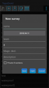
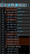
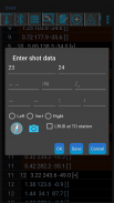
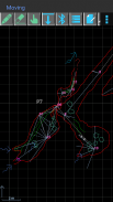
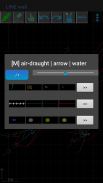
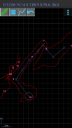
TopoDroid helps you to take survey data and accurate sketches while you are in the cave, so that you can detect errors in the data while you are still on the spot and correct them. TopoDroid has many functions to help you get the most out of a surveying trip. In this way, by the time you finish it, a working map is almost ready.
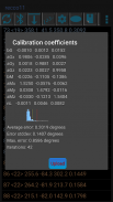
TopoDroid is designed to work *ONLY* with the DistoX (versions 1 and 2), although the survey data can be also entered by hand. TopoDroid has DistoX calibration functions, as well as other advanced DistoX functions.
NOTE. These DistoX are not a Leica products.
TopoDroid handles one survey session at a time. It is not a cave survey project manager. For that purpose there are many good PC programs, and TopoDroid exports survey data in several cave program formats (among them: therion, compass, visualtopo, walls, survex), as well as dxf, csv, kml, trackfile, shapefile. Sketches can be exported as therion, csurvey, dxf, svg, shapefile, and png image.
Full list of features, user manual, and docs on https://sites.google.com/site/speleoapps/home/topodroid
DISCLAIMER
This app is open-source, free and ad-free. It has no warranty. By using it you agree that the author is not responsible for any loss of data you might incur, or damage whatsoever, including damages to DistoX devices.
ANDROID PERMISSIONS
- TopoDroid requires the following permissions: WRITE_EXTERNAL_STORAGE, BLUETOOTH, BLUETOOTH_ADMIN
- Certain functions depend on these permissions:
CAMERA, RECORD_AUDIO, ACCESS_FINE_LOCATION.
- INTERNET permission is necessary to install translations of the user manual.
BETA and OLD APKS
TopoDroid has an open-beta program: opt-in link on the website.
A few apks of old versions are available on the website.
TRANSLATIONS
M. Guerrero (spanish), D. Ros (french), A. Kozhenkov (russian), V. Georgiev (bulgarian), M. Keller (german), F. Toso (italian), H.-J. Luo (chinese), P. Suru (hungarian), R. Severo (potuguese), M. Jurecka (slovak), K. Borgiel (polish), A. Pologea (romanian)
TopoDroid-Android上的洞穴勘测
TopoDroid帮助您在洞穴中时获取测量数据和准确的草图,以便您可以在现场时检测数据中的错误并进行更正。 TopoDroid具有许多功能,可帮助您充分利用勘测之旅。这样,当您完成它时,一张工作图就已经准备好了。
尽管也可以手动输入调查数据,但TopoDroid只能与DistoX(版本1和2)一起使用。 TopoDroid具有DistoX校准功能以及其他高级DistoX功能。
注意。这些DistoX不是Leica产品。
TopoDroid一次处理一个调查会话。它不是洞穴调查项目经理。为此,有许多优秀的PC程序,并且TopoDroid以几种洞穴程序格式(其中包括:Therion,指南针,visualtopo,墙壁,survex)以及dxf,csv,kml,trackfile,shapefile导出调查数据。草图可以导出为therion,csurvey,dxf,svg,shapefile和png图像。
https://sites.google.com/site/speleoapps/home/topodroid上的功能,用户手册和文档的完整列表
免责声明
此应用程序是开源,免费和无广告的。它没有保修。通过使用它,您同意作者对您可能招致的任何数据丢失或任何损害(包括对DistoX设备的损害)概不负责。
机器人许可
-TopoDroid需要以下权限:WRITE_EXTERNAL_STORAGE,BLUETOOTH,BLUETOOTH_ADMIN
-某些功能取决于以下权限:
CAMERA,RECORD_AUDIO,ACCESS_FINE_LOCATION。
-必须具有INTERNET权限才能安装用户手册的翻译。
测试版和旧版APKS
TopoDroid具有开放测试版程序:网站上的“选择加入”链接。
网站上提供了一些旧版本的apk。
翻译
M. Guerrero(西班牙语),D. Ros(法语),A. Kozhenkov(俄语),V. Georgiev(保加利亚语),M. Keller(德语),F. Toso(意大利语),H.-J.。罗(中文),苏鲁(匈牙利),塞韦罗(葡萄牙语),尤里卡(斯洛伐克),博吉尔(波兰),波洛加(罗马尼亚)


